

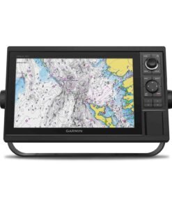
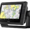
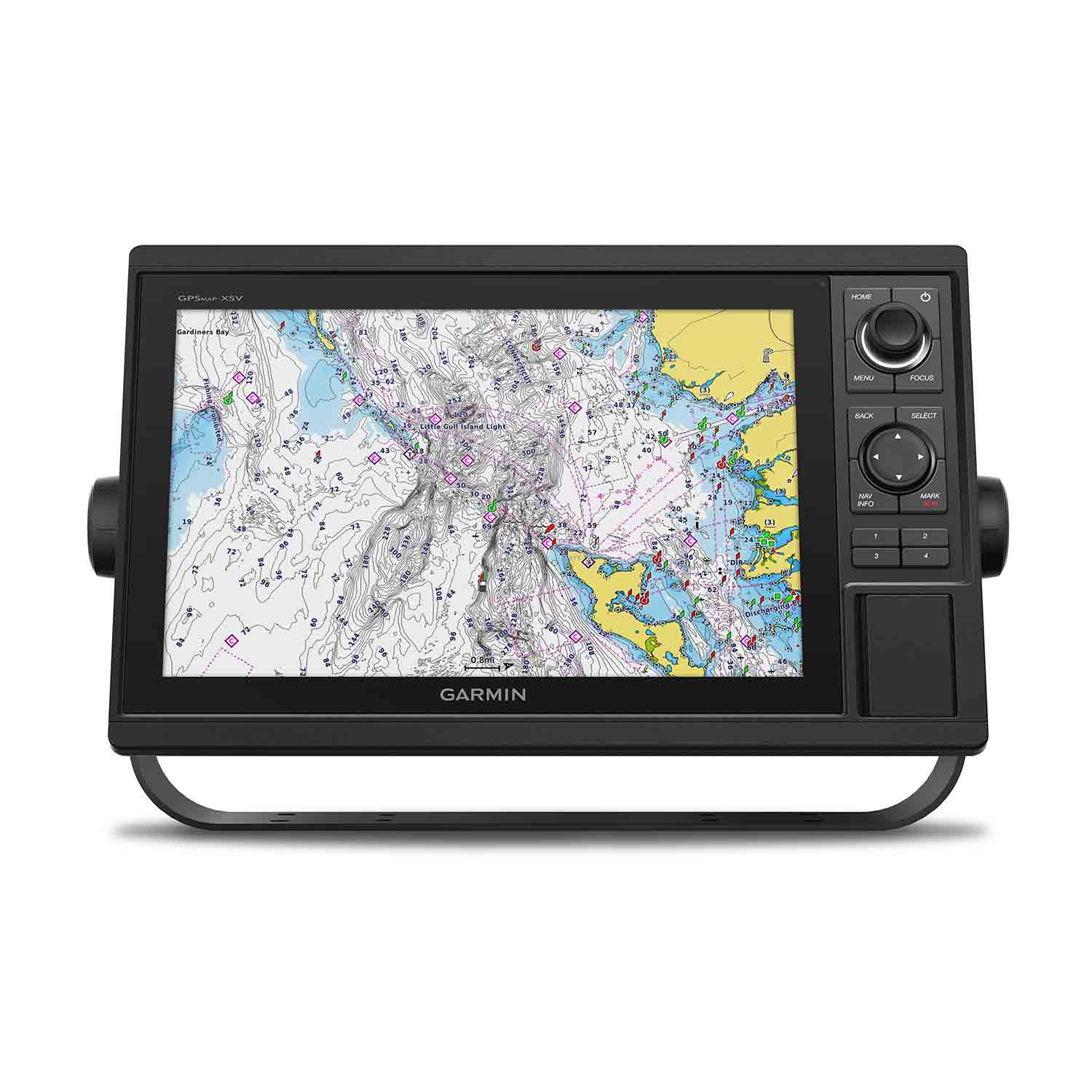
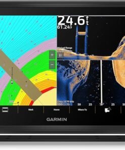
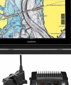
Garmin GPSMAP 1242xsv 12″ Chartplotter with Sonar, Garmin Navionics+ Mapping, and GT52HW-TM Transducer

€1,800.00

Experience an advanced all-in-1 solution with the Garmin® GPSMAP® 1242xsv 12″ Chartplotter with Sonar, Garmin Navionics+ Mapping, and GT52HW-TM Transducer. This powerhouse Garmin chartplotter has a large, bright screen coupled with a keypad interface and multifunction control knob. A GT52-TM transducer gives you Garmin CHIRP sonar along with CHIRP ClearVü™ and CHIRP SideVü™ scanning sonars. There’s also support for Panoptix™ and LiveScope™ live sonars (transducers not included). Preloaded Garmin Navionics+™ coastal charts and inland mapping features Auto Guidance+™ technology. Plus, there’s support for optional Garmin Navionics Vision+™ premium map content. This GPSMAP combo also boasts Quickdraw Contours software and the Quickdraw Community on the Garmin Connect™ online network. Use built-in Wi-Fi® technology to pair with the free ActiveCaptain® smartphone app for access to the OneChart™ feature, smart notifications, Garmin Quickdraw™ Community data, and more. Garmin Marine Network support allows sharing of sonar, maps, user data, radar, IP cameras, and live sonar among multiple units. Plus, there’s NMEA 2000® and NMEA 0183 network connectivity support including autopilots, digital switching, weather, media, VHF, AIS, and other sensors. These units also include integrated ANT® connectivity support for use with compatible quatix® smartwatches, the gWind™ Wireless 2 transducer, GNX™ Wind marine instrument, and remote controls (not included). See RPMs, fuel flow, temperature, trim, and more for up to four of your compatible Mercury® engines by using the SmartCraft® Connect gateway. The Garmin GPSMAP redefines possibilities on the water.
- 12″ extra-sharp display
- Large, bright screen with keypad interface and multifunction control knob
- GT52-TM transducer with Garmin CHIRP sonar and CHIRP ClearVü and SideVü scanning sonars
- Support for Panoptix and LiveScope live sonars (transducers not included)
- Quickdraw Contours
- Built-in Wi-Fi
- Garmin Connect online network
- Garmin Marine Network support
- NMEA 2000 and NMEA 0183 network connectivity support
- Integrated ANT connectivity
- SmartCraft Connect gateway data for Mercury engines
Specifications
| Sonar Type | 2D/Down Scanning/Side Scanning |
| Screen Size | 12 inches |
| Transducer Model | GT52 |
| GPS Included | Yes |
| Product Color | Black |
| Live Sonar Compatible | LiveScope Compatible |
| Map/Chart Type | US Freshwater/Saltwater |
| Model Number | 010-01741-60 |
| Pursuit | Saltwater Fishing |
Garmin GPSMAP 1242xsv 12″ Chartplotter with Sonar, Garmin Navionics+ Mapping, and GT52HW-TM Transducer
The Garmin GPSMAP 1242xsv 12″ Chartplotter with Sonar, Garmin Navionics+ Mapping, and GT52HW-TM Transducer is engineered to deliver professional-grade marine navigation, advanced sonar imaging, and seamless connectivity in one powerful multifunction display. Designed for serious anglers, offshore captains, and coastal cruisers alike, this premium marine electronics system transforms every journey into a safer, smarter, and more productive experience on the water.
Precision navigation is delivered through cutting-edge GPS performance. Meanwhile, ultra-clear sonar technology ensures underwater structures and fish targets are visualized with remarkable clarity. Additionally, preloaded Garmin Navionics+ mapping empowers confident route planning across inland lakes, coastal waters, and offshore destinations.
Advanced 12-Inch High-Resolution Display for Maximum Visibility
A bright, sunlight-readable 12-inch display is integrated into the GPSMAP 1242xsv, ensuring optimal clarity in all lighting conditions. Because marine environments demand durability, a rugged design has been implemented to withstand harsh conditions including spray, glare, and vibration.
Clear Viewing in Any Condition
Visibility is maintained even under direct sunlight. Moreover, touch and keyed controls provide flexible operation, allowing navigation adjustments to be made quickly and efficiently.
Designed for Helm Integration
The compact flush-mount design allows seamless installation into modern helm layouts. As a result, integration into existing marine dashboards is simplified, enhancing both aesthetics and functionality.
Built-In High-Performance Sonar Capabilities
Serious anglers require advanced sonar performance. Therefore, the Garmin GPSMAP 1242xsv includes built-in support for traditional CHIRP sonar, ClearVü, and SideVü scanning technologies.
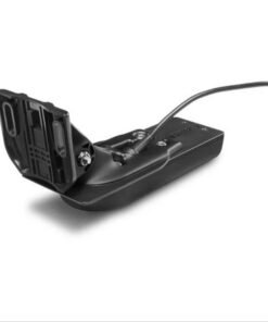
GT52HW-TM Transducer Included
The included GT52HW-TM transducer delivers:
-
High-Wide CHIRP traditional sonar for superior target separation
-
ClearVü scanning sonar for detailed views beneath the boat
-
SideVü scanning sonar for expansive side-to-side coverage
Consequently, fish arches are defined with precision. Additionally, bottom contours, structures, and bait schools are identified with enhanced clarity.
CHIRP Sonar Technology Explained
Unlike single-frequency sonar, CHIRP technology transmits across a range of frequencies. Because of this broader spectrum, improved target separation and depth penetration are achieved. As a result, anglers benefit from clearer fish identification even in deeper waters.
Garmin Navionics+ Mapping for Superior Navigation
Preloaded Garmin Navionics+ charts are included to provide detailed coastal and inland waterway coverage. Updated mapping data ensures that navigation decisions are supported by the latest chart information.
Detailed Chart Coverage
With Garmin Navionics+ mapping, users gain:
-
High-resolution bathymetric contours
-
Integrated Auto Guidance+ routing assistance
-
Regular downloadable updates
-
Comprehensive inland and coastal coverage
Therefore, safe passage planning becomes more intuitive. In addition, hazards, marinas, and depth contours are clearly marked for enhanced situational awareness.
Seamless Marine Networking and Connectivity
Modern vessels require integrated systems. Accordingly, the Garmin GPSMAP 1242xsv supports NMEA 2000 and NMEA 0183 networking protocols.
Connect Multiple Devices
The chartplotter can be connected to:
-
Radar systems
-
Autopilots
-
AIS receivers
-
VHF radios
-
Engine monitoring systems
As a result, data sharing across onboard electronics is streamlined. Furthermore, wireless connectivity enables pairing with compatible Garmin devices for enhanced control and data synchronization.
Performance-Driven Hardware for Offshore Reliability
Durability is prioritized in marine electronics. For that reason, the GPSMAP 1242xsv is constructed with high-quality materials engineered for longevity in saltwater and freshwater environments.
Rugged Marine Construction
Corrosion-resistant housing has been utilized. Additionally, waterproof design standards are met to ensure reliable operation even in demanding marine conditions.
High-Sensitivity Internal GPS
A high-performance internal GPS receiver is built into the unit. Therefore, position accuracy remains consistent even during offshore voyages or when navigating narrow inland waterways.
Why Choose the Garmin GPSMAP 1242xsv?
When performance, clarity, and reliability matter most, this chartplotter system stands out.
Key Benefits at a Glance
-
12″ high-resolution, sunlight-readable display
-
Built-in CHIRP, ClearVü, and SideVü sonar
-
GT52HW-TM transducer included
-
Garmin Navionics+ preloaded mapping
-
NMEA 2000 & NMEA 0183 network support
-
Durable marine-grade construction
-
Intuitive helm integration
Because advanced navigation and sonar are combined into one platform, vessel operation becomes more efficient. Moreover, fishing productivity is significantly enhanced.
Ideal Applications
This system is perfectly suited for:
-
Offshore sportfishing boats
-
Coastal cruising vessels
-
Freshwater bass boats
-
Multi-station yachts
-
Professional charter operations
Whether navigating open ocean routes or locating structure-rich freshwater habitats, dependable performance is consistently delivered.
Enhanced Fishing Intelligence
Productivity on the water depends on data accuracy. For that reason, sonar feedback is displayed in crisp detail, enabling real-time decision-making.
Furthermore, structure scanning allows anglers to identify drop-offs, reefs, and submerged timber with confidence. Consequently, fishing strategy is refined and optimized.
Intelligent Navigation Control for Confident Voyages
Beyond display clarity and sonar precision, advanced control systems are integrated to enhance command at the helm. Operational workflows are streamlined so that navigation decisions can be executed quickly and confidently.
Intuitive User Interface Architecture
A refined menu structure has been engineered to reduce complexity. As a result, frequently used functions are accessed with minimal input. Meanwhile, customizable home screens allow preferred data panels to be arranged according to individual boating styles.
Because clarity in marine electronics directly impacts safety, menus have been structured logically. Consequently, waypoint creation, route management, and sonar adjustments are completed efficiently.
Customizable Data Overlays
Critical navigation metrics are displayed in configurable data fields, including:
-
Speed over ground (SOG)
-
Course over ground (COG)
-
Water temperature
-
Depth readings
-
Fuel flow data (with compatible systems)
-
Engine performance metrics
Therefore, situational awareness is enhanced at all times. Additionally, multi-pane viewing allows sonar, charts, and radar overlays to be monitored simultaneously.
Advanced Sonar Layering for Tactical Fishing Precision
Fishing performance is elevated when underwater information is interpreted accurately. For this reason, multiple sonar modes are layered to provide a comprehensive underwater perspective.
Traditional CHIRP Sonar Clarity
High-Wide CHIRP frequencies are transmitted across a continuous spectrum. Because frequency sweeps are utilized instead of fixed signals, improved target separation is achieved. As a result, individual fish targets are distinguished clearly even within bait schools.
ClearVü and SideVü Scanning Detail
Structure scanning technology delivers near-photographic imagery of underwater terrain. Consequently, rocks, ledges, bridge pilings, and submerged timber are visualized with remarkable definition.
Additionally, SideVü scanning expands coverage beyond the vessel’s hull. Therefore, fish-holding structures located to port and starboard are identified before they are passed.
Offshore Confidence with Integrated Safety Features
Marine navigation requires dependable safety systems. Accordingly, the GPSMAP 1242xsv has been engineered to support advanced marine safety technologies.
AIS Compatibility for Collision Avoidance
When paired with an AIS receiver, nearby vessels are displayed directly on the chart screen. Because real-time vessel tracking data is shared, potential collision risks are minimized.
Radar Overlay Support
Compatible Garmin radar systems can be integrated seamlessly. As a result, radar returns are superimposed onto navigation charts for improved hazard awareness during low-visibility conditions.
Route Planning Efficiency with Garmin Navionics+ Mapping
Strategic route planning is simplified through detailed cartography and automated guidance features.
Auto Guidance+ Technology
Suggested routes are calculated based on vessel dimensions and chart data. Consequently, optimal paths around shallow water and obstacles are generated automatically.
Detailed Contour Mapping for Anglers
High-definition bathymetric contours allow anglers to:
-
Identify drop-offs and ledges
-
Target thermoclines and depth transitions
-
Follow contour lines precisely
-
Locate productive fishing zones
Therefore, time on the water is utilized more effectively.
Networking Power for Fully Integrated Helm Systems
Modern vessels operate as connected ecosystems. For that reason, robust marine networking capabilities are supported.
NMEA 2000 Integration
Engine data, fuel sensors, and autopilot systems are synchronized through NMEA 2000 connectivity. As a result, system-wide data sharing is achieved efficiently.
NMEA 0183 Compatibility
Legacy marine electronics can also be integrated. Consequently, compatibility is extended across a wide range of onboard systems.
Wireless Connectivity Advantages
Wireless networking allows pairing with compatible Garmin devices and mobile applications. Additionally, software updates are downloaded seamlessly, ensuring performance remains current.
Built for Harsh Marine Environments
Reliability in marine electronics depends on construction quality. Therefore, corrosion-resistant components and sealed housing are utilized.
Marine-Grade Durability
Salt spray, humidity, and vibration are accounted for in the unit’s engineering. Because marine environments can be unpredictable, reinforced internal components ensure long-term performance.
Temperature and Weather Resilience
Operation is maintained across a wide temperature range. As a result, reliability is preserved during both summer offshore excursions and cooler early-morning launches.
Expanded Control with Autopilot Integration
Long-distance cruising demands precision steering. Accordingly, compatibility with Garmin autopilot systems enables integrated helm control.
Course adjustments are executed electronically through the chartplotter interface. Consequently, steering corrections are implemented smoothly, reducing operator fatigue.
Enhanced Waypoint and Track Management
Fishing locations and navigational markers can be saved effortlessly.
Efficient Data Storage
Thousands of waypoints and routes are supported. Therefore, favorite fishing hotspots, reefs, and marina approaches are cataloged reliably.
Track Replay and Analysis
Previously traveled routes can be reviewed and analyzed. As a result, successful fishing drifts and trolling patterns are replicated with precision.
Optimized for Professional and Recreational Applications
Versatility makes the Garmin GPSMAP 1242xsv suitable for a wide range of marine users.
Ideal for:
-
Offshore sportfishing tournaments
-
Coastal navigation routes
-
Inland freshwater lakes
-
Charter captains
-
Recreational boaters seeking premium performance
Because adaptability is prioritized, both seasoned professionals and weekend boaters benefit equally.
Comprehensive Product Listing Highlights
✔ Key Specifications
-
12-inch high-resolution multifunction display
-
Built-in CHIRP, ClearVü, and SideVü sonar
-
Included GT52HW-TM transducer
-
Preloaded Garmin Navionics+ mapping
-
NMEA 2000 and NMEA 0183 compatibility
-
Wireless connectivity support
-
Flush-mount helm design
-
Rugged waterproof construction
Performance Advantages That Drive Buying Decisions
Investment in premium marine electronics is justified by performance gains. Because sonar clarity, mapping precision, and networking flexibility are combined in one integrated system, long-term value is delivered.
Moreover, installation simplicity reduces setup time. Additionally, future system expansion remains possible through Garmin ecosystem compatibility.


Navigation excellence is expected at the helm of a serious vessel. Advanced sonar clarity is demanded by committed anglers. Seamless integration is required for modern marine systems. Consequently, the Garmin GPSMAP 1242xsv 12″ Chartplotter with Sonar, Garmin Navionics+ Mapping, and GT52HW-TM Transducer has been engineered to exceed those expectations through precision hardware, intelligent software, and professional-grade connectivity.
Performance is elevated through integrated CHIRP sonar, preloaded Garmin Navionics+ cartography, and expandable marine networking. Therefore, every nautical mile is navigated with enhanced confidence, clarity, and control.
Scalable System Architecture for Future Expansion
Marine electronics investments should remain relevant over time. Accordingly, a scalable platform architecture has been implemented within the GPSMAP 1242xsv to accommodate future upgrades and accessories.
Ethernet Networking for High-Speed Data Sharing
High-speed Ethernet ports are supported to enable:
-
Radar integration
-
Panoptix™ live sonar compatibility
-
Additional multifunction display linking
-
Shared sonar data across multiple stations
As a result, multi-station vessels are equipped with synchronized real-time information. Furthermore, data redundancy enhances operational reliability offshore.
Expandable Sonar Ecosystem
Although the included GT52HW-TM transducer delivers exceptional High-Wide CHIRP, ClearVü, and SideVü performance, compatibility with additional Garmin sonar modules is supported. Therefore, offshore deep-water anglers and tournament competitors are empowered to tailor sonar performance to specific environments.
Precision Chartplotting for Demanding Conditions
Accurate positioning remains critical in coastal channels, offshore passages, and inland waterways alike. For that reason, high-sensitivity GPS and GLONASS satellite reception are utilized.
Enhanced Satellite Tracking
Signal acquisition is maintained even under challenging conditions such as:
-
Coastal cliff interference
-
Dense marina infrastructure
-
Variable atmospheric conditions
Consequently, consistent vessel positioning is achieved.
Advanced Waypoint Organization
Efficient waypoint management is facilitated through intuitive tagging and categorization. Additionally, customizable symbols improve visual recognition on chart overlays.
Tournament-Level Fishing Intelligence
Competitive anglers require tactical advantages. Therefore, sonar signal clarity, bottom discrimination, and structure identification are optimized within the GPSMAP 1242xsv.
Real-Time Structure Recognition
Detailed imaging enables:
-
Identification of submerged timber
-
Recognition of reef edges
-
Detection of thermocline transitions
-
Visualization of baitfish clusters
Because underwater terrain is interpreted more accurately, strategic fishing decisions are made with confidence.
Target Separation Performance
Fish holding tight to structure are displayed distinctly due to advanced CHIRP processing. As a result, ambiguous sonar returns are minimized and hook-up opportunities are increased.
Ergonomic Helm Command Experience
Ease of operation directly influences marine safety and efficiency. Accordingly, tactile keypad controls are combined with responsive interface navigation.
Hybrid Control Flexibility
Operational adjustments are executed using physical keys, ensuring reliability even in wet conditions. Meanwhile, quick-access menu shortcuts accelerate workflow efficiency.
Split-Screen Optimization
Multiple data panels are displayed simultaneously. Therefore, sonar, charts, radar, and engine data are monitored in parallel without compromising readability.
Data-Driven Boating with Engine & System Monitoring
Modern boaters demand comprehensive vessel analytics. Because NMEA 2000 connectivity is supported, real-time engine and fuel metrics are integrated into the display.
Integrated System Awareness
When connected to compatible sensors, the following data is displayed:
-
Fuel consumption rates
-
Engine RPM
-
Oil pressure
-
Battery voltage
-
Trim levels
Consequently, mechanical awareness is maintained and preventative maintenance planning is supported.
Installation Versatility for Multiple Vessel Types
Flexibility in mounting options is provided to accommodate diverse helm configurations.
Flush or Bracket Mounting
Both flush-mount and bail-mount installation methods are supported. Therefore, installation is simplified across center consoles, sportfish yachts, pontoon boats, and cabin cruisers.
Transom-Mount Simplicity
The GT52HW-TM transducer is designed for streamlined transom installation. As a result, setup time is minimized while sonar accuracy is preserved.
Environmental Responsibility & Efficiency
Sustainable marine practices are increasingly prioritized. For that reason, energy-efficient processing components are incorporated to reduce overall power draw.
❓ Frequently Asked Questions (FAQ)
1. What is included in the box with the Garmin GPSMAP 1242xsv?
The package is supplied with everything required for standard installation. Specifically, the following components are included:
-
Garmin GPSMAP 1242xsv 12″ multifunction display
-
GT52HW-TM Transducer
-
Power/data cable
-
Mounting hardware (flush and bracket options)
-
Protective cover
-
Documentation
Therefore, sonar capability can be utilized immediately after installation.
2. Does this model include preloaded maps?
Yes. Garmin Navionics+ mapping is preloaded. Detailed coastal and inland waterway charts are provided, including high-resolution depth contours and navigational aids.
Additionally, downloadable updates are supported. Consequently, chart data remains current and reliable.
3. What type of sonar technology is supported?
Multiple sonar technologies are integrated:
-
High-Wide CHIRP traditional sonar
-
ClearVü scanning sonar
-
SideVü scanning sonar
Because CHIRP frequencies are transmitted across a spectrum rather than a single frequency, improved target separation and clarity are achieved. As a result, fish and structures are displayed with enhanced definition.
4. Is the GT52HW-TM transducer suitable for saltwater use?
Yes. The included transducer is designed for both freshwater and saltwater applications. Marine-grade materials are utilized to ensure durability in harsh conditions.
However, regular rinsing after saltwater use is recommended to maintain long-term performance.
5. Can radar and AIS systems be connected?
Radar and AIS integration are fully supported. When compatible Garmin radar and AIS modules are connected via Ethernet or NMEA networking, vessel traffic and radar overlays are displayed directly on the chart screen.
Therefore, situational awareness is significantly enhanced in low-visibility conditions.
6. Does this unit support autopilot integration?
Autopilot compatibility is provided through NMEA 2000 networking. Course adjustments can be managed through the chartplotter interface when connected to compatible Garmin autopilot systems.
As a result, long-distance cruising becomes more efficient and less fatiguing.
7. Is the display readable in direct sunlight?
A high-brightness, sunlight-readable display has been engineered specifically for marine environments. Glare resistance and high contrast ensure visibility even during midday offshore conditions.
8. How many waypoints and routes can be saved?
Thousands of waypoints and multiple route tracks are supported. Therefore, fishing hotspots, navigation channels, and preferred cruising paths can be stored and accessed quickly.
9. What networking options are available?
The Garmin GPSMAP 1242xsv supports:
-
NMEA 2000
-
NMEA 0183
-
Garmin Marine Network (Ethernet)
-
Wireless connectivity (with compatible devices)
Because multiple networking standards are supported, both modern and legacy marine systems can be integrated seamlessly.
10. Is professional installation required?
Professional installation is not mandatory. However, proper wiring, transducer mounting, and network configuration should be completed according to manufacturer guidelines.
For optimal sonar accuracy and clean cable routing, professional marine installation is often recommended.
11. Can additional sonar modules be added later?
Yes. Expansion modules and advanced sonar accessories can be integrated through Garmin Marine Network connectivity.
Consequently, the system remains scalable for future upgrades.
12. Is this chartplotter suitable for beginners?
Although advanced features are included, the interface is designed to be intuitive. Menu structures are organized logically, and key functions are accessible quickly.
Therefore, both experienced captains and newer boat owners are supported effectively.
13. What size boats is this model best suited for?
The 12-inch display is ideal for:
-
Center consoles
-
Sportfishing boats
-
Cabin cruisers
-
Pontoon boats
-
Mid-size yachts
Because of its screen size and networking capability, it performs best on vessels where clear visibility and system integration are priorities.
14. How does CHIRP sonar improve fish detection?
Traditional sonar transmits at a single frequency. In contrast, CHIRP sonar sweeps across a range of frequencies.
As a result:
-
Better target separation is achieved
-
Clearer fish arches are displayed
-
Reduced signal noise is experienced
-
Improved bottom tracking occurs in deeper water
Consequently, anglers gain a measurable advantage.
15. Why choose the Garmin GPSMAP 1242xsv over other 12-inch chartplotters?
A combination of integrated sonar, premium mapping, networking flexibility, and marine-grade durability distinguishes this model.
Additionally, the inclusion of the GT52HW-TM transducer adds immediate value. Therefore, comprehensive navigation and fishing intelligence are delivered in one integrated solution.
| Sonar Type: | 2D-Down Scanning-Side Scanning |
|---|---|
| Color: | Black |
| GPS Included: | Yes |
| Transducer Model: | GT52 |
| Screen Size: | 12 inches |
Be the first to review “Garmin GPSMAP 1242xsv 12″ Chartplotter with Sonar, Garmin Navionics+ Mapping, and GT52HW-TM Transducer”
Related products
Fish Finder & Navigation
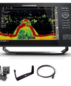
Humminbird XPLORE 10 CMSI+ CHIRP MEGA SI Fish Finder/Chartplotter
Fish Finder & Navigation
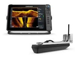
Lowrance Eagle 7 Fish Finder/Chartplotter with SplitShot HD Transducer
Fish Finder & Navigation
Lowrance Elite FS 12 Fish Finder/Chartplotter with TotalScan Transducer
Fish Finder & Navigation
Fish Finder & Navigation
Fish Finder & Navigation
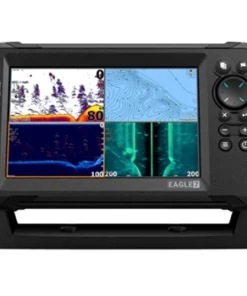
Humminbird XPLORE 12 CMSI+ CHIRP MEGA SI Fish Finder/Chartplotter
Fish Finder & Navigation
Humminbird XPLORE 9 CMSI+ CHIRP MEGA SI Fish Finder/Chartplotter
Fish Finder & Navigation
Garmin ECHOMAP UHD2 93SV GT54 Transducer with LiveScope Plus LVS34 Bundle
Reviews
There are no reviews yet.