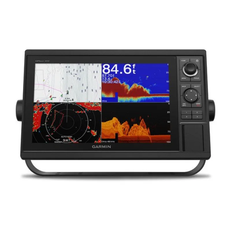
Garmin GPSMAP 1242xsv 12″ Chartplotter with Sonar, Garmin Navionics+ Mapping, and GT52HW-TM Transducer
€1,784.00

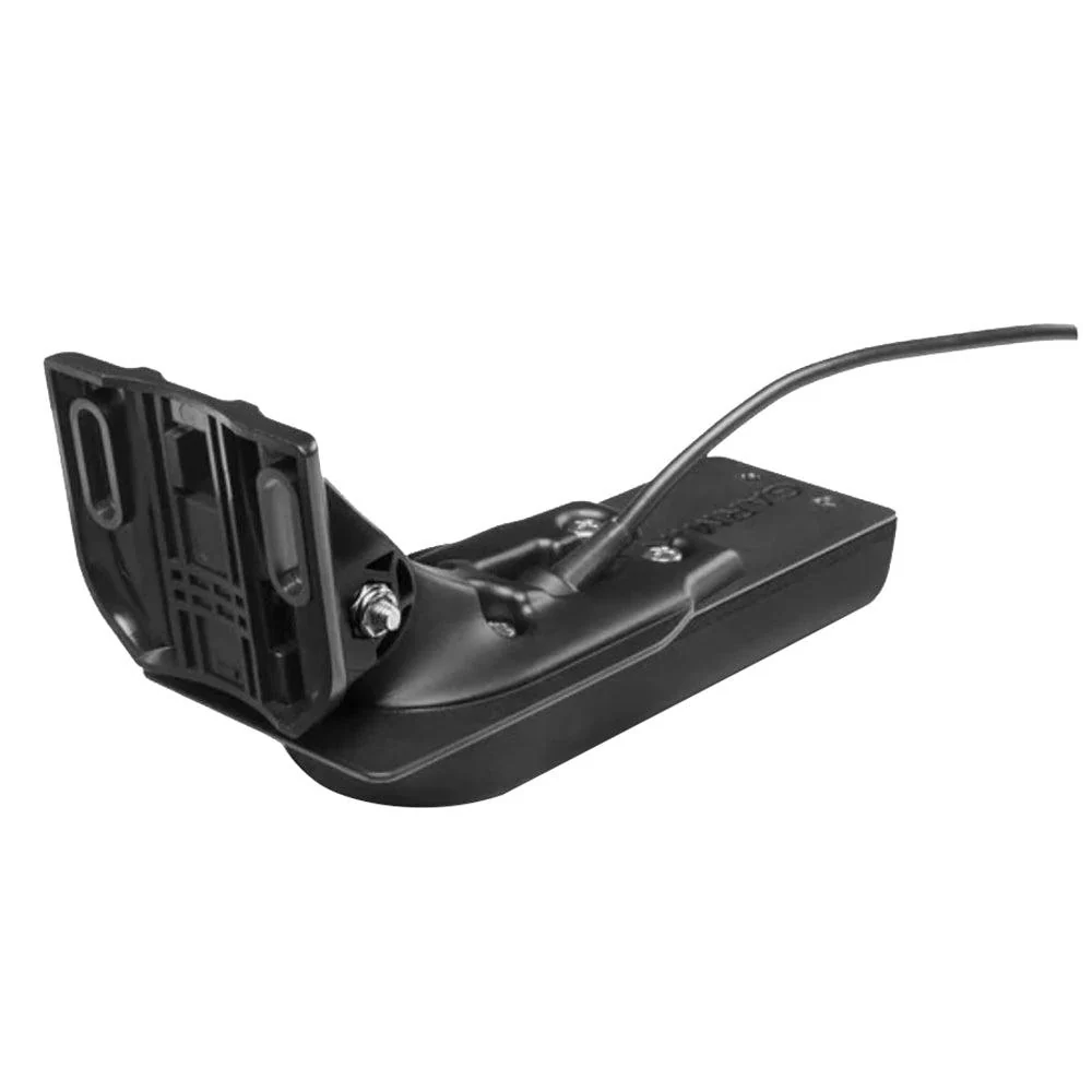
Experience an advanced all-in-1 solution with the Garmin® GPSMAP® 1242xsv 12″ Chartplotter with Sonar, Garmin Navionics+ Mapping, and GT52HW-TM Transducer. This powerhouse Garmin chartplotter has a large, bright screen coupled with a keypad interface and multifunction control knob. A GT52-TM transducer gives you Garmin CHIRP sonar along with CHIRP ClearVü™ and CHIRP SideVü™ scanning sonars. There’s also support for Panoptix™ and LiveScope™ live sonars (transducers not included). Preloaded Garmin Navionics+™ coastal charts and inland mapping features Auto Guidance+™ technology. Plus, there’s support for optional Garmin Navionics Vision+™ premium map content. This GPSMAP combo also boasts Quickdraw Contours software and the Quickdraw Community on the Garmin Connect™ online network. Use built-in Wi-Fi® technology to pair with the free ActiveCaptain® smartphone app for access to the OneChart™ feature, smart notifications, Garmin Quickdraw™ Community data, and more. Garmin Marine Network support allows sharing of sonar, maps, user data, radar, IP cameras, and live sonar among multiple units. Plus, there’s NMEA 2000® and NMEA 0183 network connectivity support including autopilots, digital switching, weather, media, VHF, AIS, and other sensors. These units also include integrated ANT® connectivity support for use with compatible quatix® smartwatches, the gWind™ Wireless 2 transducer, GNX™ Wind marine instrument, and remote controls (not included). See RPMs, fuel flow, temperature, trim, and more for up to four of your compatible Mercury® engines by using the SmartCraft® Connect gateway. The Garmin GPSMAP redefines possibilities on the water.
- 12″ extra-sharp display
- Large, bright screen with keypad interface and multifunction control knob
- GT52-TM transducer with Garmin CHIRP sonar and CHIRP ClearVü and SideVü scanning sonars
- Support for Panoptix and LiveScope live sonars (transducers not included)
- Quickdraw Contours
- Built-in Wi-Fi
- Garmin Connect online network
- Garmin Marine Network support
- NMEA 2000 and NMEA 0183 network connectivity support
- Integrated ANT connectivity
- SmartCraft Connect gateway data for Mercury engines
Specifications
| Sonar Type | 2D/Down Scanning/Side Scanning |
| Screen Size | 12 inches |
| Transducer Model | GT52 |
| GPS Included | Yes |
| Product Color | Black |
| Live Sonar Compatible | LiveScope Compatible |
| Map/Chart Type | US Freshwater/Saltwater |
| Model Number | 010-01741-60 |
| Pursuit | Saltwater Fishing |
Description
Garmin GPSMAP 1242xsv 12″ Chartplotter with Sonar, Garmin Navionics+ Mapping, and GT52HW-TM Transducer
Advanced Marine Navigation, Visualization, and Sonar Intelligence—Engineered for Confident Decisions on the Water
Introduction: A New Standard for Integrated Marine Electronics
Across modern boating environments, expectations for precision, clarity, and reliability have been steadily elevated. As a result, marine electronics solutions have increasingly been evaluated not only for raw performance, but also for how intuitively information is delivered and how confidently decisions can be supported. With those expectations firmly in place, the Garmin GPSMAP 1242xsv 12″ Chartplotter with Sonar, Garmin Navionics+ Mapping, and GT52HW-TM Transducer has been positioned as a comprehensive navigation and sonar ecosystem—one that has been engineered to support anglers, cruisers, and offshore explorers alike.
Rather than being presented as a single-purpose display, this advanced chartplotter has been designed as a central command hub. Through seamless integration of high-resolution charting, premium sonar capabilities, and industry-leading mapping content, situational awareness is consistently enhanced. Consequently, greater confidence is supported whether unfamiliar waters are being explored or well-known routes are being revisited under changing conditions.
Importantly, inclusive usability has been prioritized throughout the design. Regardless of experience level, critical data is presented clearly, controls are kept intuitive, and customization options are made accessible. In this way, technology is placed in service of people—not the other way around.
High-Resolution 12-Inch Display for Superior On-Water Visibility
Sunlight-Readable Touchscreen Clarity
At the core of the Garmin GPSMAP 1242xsv experience, a large 12-inch touchscreen display has been incorporated to ensure that essential navigation and sonar data can be viewed effortlessly. Even under intense sunlight or challenging glare conditions, details are rendered with exceptional sharpness. As a result, charts, sonar returns, and navigational overlays are kept readable at a glance.
Because a high-resolution IPS display is utilized, color accuracy and contrast are preserved across wide viewing angles. Therefore, information can be interpreted quickly from multiple positions at the helm, which is particularly valuable in shared or family boating environments. Moreover, eye strain is minimized during extended use, contributing to a more comfortable and inclusive experience for everyone on board.
Intuitive Touch and Keyed Controls
In addition to responsive touch input, keyed controls are also provided. Through this hybrid approach, reliable operation is maintained even in rough seas or wet conditions. Consequently, accessibility is improved for a broader range of users, including those who prefer tactile feedback or gloves-on operation.
Because menus are logically organized and clearly labeled, learning curves are reduced. Furthermore, customizable data fields and layouts are supported, allowing the interface to be adapted to individual preferences. In effect, the display becomes not just powerful, but personal.
Integrated Sonar Technology for Precise Underwater Awareness
Built-In Traditional, ClearVü, and SideVü Sonar Support
Advanced sonar functionality has been fully integrated into the Garmin GPSMAP 1242xsv, ensuring that underwater environments can be interpreted with confidence. Traditional CHIRP sonar support is included to deliver crisp fish arches and clear bottom separation. Meanwhile, ClearVü and SideVü scanning sonar technologies are supported to provide near-photographic images of structure, vegetation, and fish movement.
As a result, situational awareness beneath the surface is dramatically improved. Instead of relying on guesswork, informed decisions can be made based on detailed, real-time data. This capability is especially valued in fishing scenarios, where precise identification of fish-holding structure can directly influence success.
GT52HW-TM Transducer for High-Wide CHIRP Performance
Included with this system, the GT52HW-TM transducer has been selected to maximize sonar performance across a wide range of depths and conditions. Through high-wide CHIRP technology, broader sonar coverage is achieved without sacrificing target separation. Consequently, more fish and structural details are revealed within each pass.
Because ClearVü and SideVü elements are integrated into the same transducer housing, installation complexity is reduced. Additionally, consistent performance is maintained whether shallow flats or deeper offshore waters are being navigated. In this way, versatility is delivered without compromise.
Garmin Navionics+ Mapping for Confident Navigation
Comprehensive Coastal and Inland Coverage
With Garmin Navionics+ mapping included, an extensive library of coastal and inland charts is made available. Detailed contours, depth shading, navigational aids, and points of interest are presented in a clear, visually intuitive format. Therefore, routes can be planned with precision and confidence before departure—and adjusted dynamically while underway.
Importantly, chart data is continually updated. As a result, evolving waterways, newly identified hazards, and updated marina information are kept current. Through this commitment to accuracy, trust is reinforced with every voyage.
Advanced Mapping Features for Enhanced Decision-Making
Beyond basic charting, Garmin Navionics+ mapping introduces advanced features such as shallow water shading and high-definition contours. Because depth ranges can be color-coded, potential hazards are highlighted instantly. Consequently, safer navigation is supported, particularly in unfamiliar or restricted areas.
Additionally, dynamic tide and current information is incorporated. Through this integration, environmental factors are visualized directly on the chart, enabling more informed timing and routing decisions. Ultimately, confidence is built not only through data availability, but through how clearly that data is communicated.
Performance-Driven Processing and System Responsiveness
Fast Internal Processing for Smooth Operation
Behind the scenes, powerful internal processing ensures that maps, sonar images, and overlays are rendered smoothly. Lag is minimized, transitions are fluid, and zooming or panning actions are executed instantly. As a result, focus is kept on navigation and situational awareness rather than on waiting for screens to refresh.
Because multiple data sources can be displayed simultaneously, efficiency at the helm is significantly improved. For example, charts and sonar can be viewed side by side without performance degradation. In busy or demanding conditions, this responsiveness becomes particularly valuable.
Seamless Integration with Marine Networks
Designed to operate as part of a broader marine electronics ecosystem, the Garmin GPSMAP 1242xsv supports seamless integration with radar, autopilot systems, engine data, and other onboard sensors. Through network connectivity, information is centralized and simplified.
Consequently, decision-making is supported by a holistic view of vessel performance and surroundings. Instead of switching between separate devices, data is consolidated into one cohesive interface. In this way, complexity is reduced and confidence is reinforced.
Flexible Installation and Inclusive Design
Multiple Mounting Options for Diverse Helm Configurations
Flexibility has been prioritized to ensure that the Garmin GPSMAP 1242xsv can be accommodated across a wide range of vessels. Both flush-mount and bail-mount installation options are supported. Therefore, the display can be integrated seamlessly into custom dashboards or mounted conveniently on existing helm structures.
Because thoughtful cable management and mounting hardware are included, installation is simplified. As a result, professional installers and experienced DIY users alike are supported.
Designed for Shared Use and Accessibility
Throughout the interface and physical design, inclusivity has been carefully considered. Large icons, clear fonts, and customizable layouts ensure that information remains readable for users with varying visual preferences. Meanwhile, intuitive controls support confident use by operators of different experience levels.
By reducing barriers to understanding and operation, the system is made welcoming for everyone on board. Whether navigation duties are shared or learned gradually, support is consistently provided.


Safety-Focused Navigation for Confident Passage Planning
Enhanced Chart Awareness for Hazard Avoidance
When navigating unfamiliar or complex waterways, risk awareness is consistently elevated through high-definition charting. With Garmin Navionics+ mapping in operation, depth contours, navigation aids, and obstructions are presented with exceptional clarity. As a result, potential hazards are identified earlier, and corrective actions are taken with greater confidence.
Because shallow water shading can be customized, areas of concern are visually emphasized. Consequently, safe routes are reinforced at a glance, while high-risk zones are clearly distinguished. Through this visual prioritization, navigation safety is supported for operators of all experience levels.
Tide, Current, and Environmental Data Integration
Environmental conditions often influence both safety and efficiency. For that reason, tide and current information is directly overlaid onto navigational charts. By visualizing these forces in real time, timing and routing decisions are improved.
Additionally, awareness of changing conditions supports inclusive planning. Whether trips are being organized around accessibility needs, fuel efficiency, or comfort preferences, informed choices are made easier. In this way, navigation becomes not only safer, but more considerate of everyone on board.
Long-Range Cruising Confidence and Route Optimization
Intelligent Route Planning and Monitoring
For extended cruising, precision planning is essential. With the Garmin GPSMAP 1242xsv, routes can be created in advance and monitored continuously while underway. Because distance, bearing, and arrival data are displayed clearly, progress is tracked without distraction.
Moreover, routes can be adjusted dynamically as conditions change. As weather, traffic, or visibility shifts, alternative paths are evaluated and implemented with minimal effort. Consequently, flexibility is preserved without sacrificing confidence.
Day and Night Operation for Continuous Awareness
Visibility requirements vary dramatically between daylight and nighttime operation. To address this, day and night display modes are provided. Color schemes are automatically or manually adjusted to maintain readability while minimizing glare.
As a result, eye comfort is preserved during long passages, and situational awareness remains consistent. Whether early departures or late arrivals are planned, navigation support remains dependable.
Real-World Use Cases Across Boating Styles
Offshore Fishing and Blue-Water Exploration
In offshore environments, accurate navigation and sonar performance are essential. The Garmin GPSMAP 1242xsv has been positioned as a reliable partner for blue-water anglers and explorers. By combining high-wide CHIRP sonar, detailed mapping, and stable processing, confidence is reinforced far from shore.
Because long-range situational awareness is maintained, decisions are guided by data rather than uncertainty. In turn, safety margins are improved and enjoyment is enhanced.
Coastal Cruising and Family Boating
For coastal cruising and family outings, ease of use and clarity are often prioritized. Through intuitive controls, clear displays, and inclusive design, shared operation is encouraged. Navigation responsibilities can be transferred smoothly, ensuring that everyone feels supported.
Additionally, points of interest, marinas, and safe anchorage locations are easily identified. As a result, planning becomes collaborative and stress is reduced for all participants.
Confidence Through Redundancy and System Awareness
Integrated Alerts and System Feedback
Proactive alerts are essential for maintaining safety. With customizable alarms for depth, arrival, and system status, attention is directed where it is most needed. These notifications are presented clearly without overwhelming the operator.
Because feedback is timely and relevant, risks are addressed before they escalate. Consequently, confidence is maintained even in complex or crowded waterways.
Consistent Performance That Builds Trust
Over time, trust in marine electronics is built through consistent performance. The Garmin GPSMAP 1242xsv delivers reliable operation across varied conditions, reinforcing confidence on every outing.
By reducing uncertainty and supporting informed decisions, this system becomes an integral part of safe and enjoyable boating experiences.
Purpose-Built Fishing Features for Strategic Success
Sonar Visualization That Supports Smarter Decisions
Within demanding fishing environments, clarity beneath the surface has consistently been recognized as a decisive advantage. Through the Garmin GPSMAP 1242xsv platform, sonar data is transformed into highly interpretable visual information. Rather than being displayed as abstract signals, fish targets, structure, and bottom composition are rendered with remarkable definition.
Because ClearVü and SideVü imaging is supported at high frequencies, near-photographic representations of the underwater world are delivered. As a result, fish-holding areas can be identified quickly, while unproductive water can be ruled out with confidence. In turn, time on the water is used more efficiently, and effort is focused where results are most likely to be achieved.
Furthermore, inclusive design principles are reinforced through adjustable color palettes and gain settings. By allowing displays to be tuned to individual visual preferences, accessibility is enhanced for all users on board.
High-Wide CHIRP Coverage for Broader Scanning
With the GT52HW-TM transducer in operation, high-wide CHIRP sonar coverage is achieved across a wider cone angle. Consequently, larger areas beneath the vessel are scanned in each pass. This expanded coverage ensures that fish schools and structural transitions are less likely to be missed.
Importantly, strong target separation is preserved even within the wider beam. Therefore, individual fish can still be distinguished from bottom clutter or vegetation. Through this balance of coverage and clarity, strategic fishing decisions are supported without compromise.
Customization and Data Control for Personalized Operation
User-Defined Screens and Data Layouts
Because no two boating or fishing styles are identical, extensive customization has been made available within the Garmin GPSMAP 1242xsv interface. Screens can be configured to display charts, sonar, engine data, and radar information in combinations that best suit individual needs.
As a result, essential information is always placed front and center. Whether emphasis is placed on sonar detail during fishing or on chart clarity during cruising, layouts can be adapted effortlessly. Over time, this flexibility contributes to reduced cognitive load and improved confidence at the helm.
Waypoints, Routes, and Tracks for Repeatable Success
Navigation success is often built on consistency. For that reason, waypoint marking, route creation, and track recording have been seamlessly integrated. Productive fishing spots can be saved, favorite routes can be reused, and travel history can be reviewed in detail.
Because these features are presented within an intuitive interface, knowledge gained over time is preserved and easily revisited. In effect, each outing contributes to a growing library of experience that supports future success.
Network Expansion and System Integration
Centralized Control Through Garmin Marine Networks
As vessels become increasingly sophisticated, centralized data management has been recognized as essential. The Garmin GPSMAP 1242xsv has therefore been designed to integrate smoothly within Garmin Marine Networks. Radar, autopilot systems, engine instrumentation, and environmental sensors can all be connected.
Through this integration, fragmented information is replaced with a unified operational view. Consequently, situational awareness is improved, and decision-making is supported by a complete understanding of vessel status and surroundings.
Multi-Station Display and Shared Data
For larger vessels or collaborative boating environments, multi-station display support has been incorporated. Chart, sonar, and waypoint data can be shared across compatible Garmin displays throughout the vessel.
As a result, coordination between helm stations is improved. Whether navigation responsibilities are shared or transitioned, continuity is preserved. This inclusive approach ensures that everyone on board remains informed and aligned.
Reliability in Challenging Marine Conditions
Engineered for Offshore and Rough-Water Use
Marine environments are inherently unpredictable. For that reason, durability and reliability have been prioritized throughout the design of the Garmin GPSMAP 1242xsv. Components are engineered to withstand vibration, moisture, and temperature variations commonly encountered offshore.
Because performance remains consistent under pressure, trust is built over time. When conditions become demanding, technology is expected to perform without distraction—and this expectation is met.
Stable Performance During High-Demand Operation
Even when multiple data sources are displayed simultaneously, system stability is preserved. Sonar imaging, chart updates, and networked data continue to function smoothly. Therefore, confidence is maintained during complex maneuvers or high-traffic navigation scenarios.
By minimizing interruptions and preserving clarity, focus is kept where it belongs—on safe and successful operation.
Additional information
| Sonar Type: | 2D-Down Scanning-Side Scanning |
|---|---|
| Color | : Black |
| GPS Included: Yes | Yes |
| Transducer Model: | GT52 |
| Screen Size: | 12 inches |
Related products
-
Humminbird HELIX 7 CHIRP SI GPS G4 Fish Finder/Chartplotter – G4
€416.00Select options This product has multiple variants. The options may be chosen on the product page -
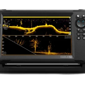
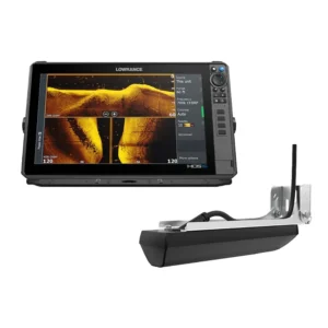
Lowrance Eagle Eye 9″ Fish Finder with Live Sonar
€675.00Select options This product has multiple variants. The options may be chosen on the product page -

Humminbird HELIX 5 CHIRP GPS G3 Fish Finder/Chartplotter
€299.00Select options This product has multiple variants. The options may be chosen on the product page -
Reviews
There are no reviews yet.